
Browse the Louisville Street Directory by Address
An address search in Louisville is a chain, not a single resident result. Begin with the street and number as supplied, then keep the source date beside every name. The Boulder County Assessor Property Search can return an owner, parcel, legal description, mailing address, sales history, and building clues. The E-Mapping view adds the parcel next door. The recorder adds legal parties. A voter match and a historic directory entry add separate forms of evidence, but neither should be treated as a complete household list.
The most reliable walkthrough moves from a current address to the parcel, then from the parcel to documents and older sources. It also preserves gaps. A mailing address may belong to an entity or agent, a permit contact may be a project participant, and an old street label may not match the modern city line.
- Run the street name or full address through the Boulder County Assessor Property Search. Save the account number, parcel number, owner, mailing address, situs address, subdivision, and legal description.
- Open the same location in the county map viewer. Click the target parcel, record its ID, then pan and click each parcel along the street. Use the municipality filter when it is available, and keep adjoining parcels separate.
- Use the legal description and current owner as keys in the recorder index. Read the watermarked image, reception number, document type, date, grantor, grantee, and legal description before following a prior party.
- Use the Colorado voter lookup only for an individual match with the required first name, last name, ZIP, and birthday. A street-wide voter browse is not the public search mode.
- Test older address clues in the local directory indexes, telephone book, newspapers, and museum collections. Search the old spelling, cross street, business, or mine-neighborhood label when a modern number fails.
Louisville Street Directory Records by Street
The address-keyed record sets below overlap, but they do not describe the same person role. The assessor describes a tax parcel and its recorded owner. GIS describes mapped land and planning layers. The recorder indexes parties to instruments. Permit systems describe a project. The voter system describes an individual registration match, while a historic directory describes a person or business in a particular year.
| Record set | Keeper | Address key | Evidence | Access |
|---|---|---|---|---|
| Assessor parcel card | Boulder County Assessor | Address, account, parcel, subdivision | Owner, mailing and situs, values, sales, legal description | Free Property Search; daily public datasets |
| GIS parcel map | Boulder County GIS | Map click, parcel, coordinates | Adjacent parcels, zoning, floodplain, districts | Free E-Mapping and map downloads |
| Deed and instrument index | Clerk & Recorder | Grantor, grantee, legal description, date | Deeds, liens, plats, releases, foreclosure instruments | Online index and watermarked images; copies by request |
| Permits and planning | Boulder County and Louisville | Site address, parcel, permit or license | Reviews, inspections, plans, attachments, project contacts | Accela, CSS, city forms, or records request |
| Voter information | Colorado Secretary of State | Person, ZIP, birthday | Registration match and public voter fields | Individual lookup or authorized data request |
| Historic directory and news | Carnegie, museum, CHNC and local collections | Historical street, town, year, name | Past occupant, business, phone, obituary and address clues | Digital indexes, archive visits, microfilm, or staff help |
A parcel number can bridge the assessor card to sales and recorder instruments. A street name can bridge a permit or directory entry to a map, but a street name alone cannot prove that a person lived there. The final column matters because each custodian has a different fallback: a map visit, a copy request, an election data form, a library appointment, or a narrowly written public-record request.
Louisville Assessor Search for a Street
The assessor portal is the strongest first stop when the starting clue is an address. Its text search accepts address, owner name, street name, subdivision, account, parcel, and S-T-R. A map browse can locate a parcel when spelling is uncertain. The visible controls include Clear, Status, and Municipalities. The result card can then be expanded into assessment, taxes, sales, zoning and septic, permit and docket, floodplain, and related property panels.
The field names explain why two address fields must be saved. The published schema calls the physical location PROPERTY_ADDRESS. Mailing fields use ADDRESS1, ADDRESS2, city, state, and ZIP. Other useful fields include OWNER_NAME, PARCELNB, ACCOUNTNO, SUBDIVISION, GRANTEE, GRANTOR, RECEPTION_NO, SALE_DATE, and SALE_PRICE. Those fields make an address workflow reproducible without turning an owner field into a residence claim.
| Interface | Fields and controls documented by the county |
|---|---|
| Assessor text search | Address, owner name, street name, subdivision, account, parcel, S-T-R, Clear, Status, Municipalities |
| Parcel card | Address, account, parcel, lot size, estimated acres, subdivision, neighborhood, market area, legal description, owner, mailing address, tax year, actual values, sales, permits and floodplain |
| GIS map | Map, zoom, pan, click, Status, Clear, Municipalities; coordinate page with Easting, Northing, Locate, and NAD 1983 HARN StatePlane Colorado North |
| Assessor download schema | OWNER_NAME, PROPERTY_ADDRESS, mailing address fields, PARCELNB, ACCOUNTNO, SUBDIVISION, NBHD, LOCCITY, GRANTEE, GRANTOR, RECEPTION_NO, SALE_DATE, SALE_PRICE, building, land, and value fields |
| Treasurer EagleWeb | Account, parcel without dashes, owner, situs street number and name, optional city or ZIP, legal subdivision/block/lot, section/township/range, sale date and price, wildcards |
The county publishes daily CSV and GIS datasets for owners and addresses, accounts and parcels, buildings, land, permits, sales, tax areas, values, and boundaries. Assessor service points include Boulder, Longmont, and Lafayette; the published assessor phone is 303-441-3530, and parcel questions are directed to 303-441-4830. The data is useful for a dated search, but the county says GIS and property estimates are not survey quality.
The Boulder County assessor field definitions make the distinction visible in a compact reference. The image below is the captured field-definition view used to read owner, mailing, situs, parcel, and sales fields.
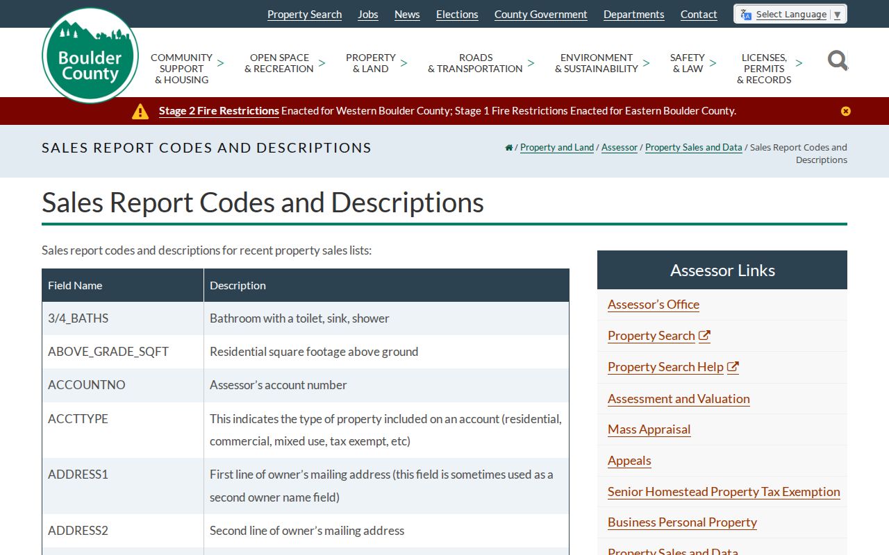
Use the field labels as a record key. A mailing address outside Louisville can describe an absentee owner, trust, estate, business, or tax agent, while the situs address remains the place being mapped.
Note: Boulder County’s parcel estimates support research, but a boundary question requires a licensed surveyor and the source’s current disclaimer.
Louisville GIS Street Parcel Map
Boulder County E-Mapping is the spatial half of the address workflow. The county GIS program publishes parcel, zoning, floodplain, land-use, open-space, road, wildfire, precinct, tax, and related layers. The public viewer uses map browse, zoom, pan, click, Status, Clear, and Municipalities. A coordinate page exposes Easting, Northing, and Locate in the county’s documented NAD 1983 HARN StatePlane Colorado North system.
Search or browse to the target parcel, click it, and carry the parcel ID into the property result. Then pan along the street and click contiguous parcels one at a time. The no-JavaScript inspection did not expose a dedicated radius, buffer, or all-neighbors control. Manual parcel capture is therefore the documented method for a street or block list. Record whether an alley or cross street separates each parcel, and do not read a map outline as a survey boundary.
The Boulder County GIS parcel and map information supplies the local layer descriptions behind the viewer. The captured map image shows why a street search needs both a parcel key and a spatial check.
The map adds context, not a list of household members. Use it to find the next parcel, identify a subdivision or planning layer, and then return to the appropriate custodian for the record itself.
Louisville Address Fields: Situs, Mailing, Legal
Four address strings can point to one Louisville property while answering four different questions. The physical location is the situs address used by the assessor, GIS, permits, zoning, and parcel map. The mailing address is where tax or official notices go. The legal description identifies the land in deeds and plats. The postal last line is the city name and ZIP selected by delivery rules. Copying only one field can break the chain.
Keep the exact spelling and punctuation from the source. A tax mailing address may be outside Louisville. A legal description may identify a lot and block even when an old street number has changed. A USPS city line can suggest Louisville without establishing the municipal boundary. The same care helps when an early directory uses a mine neighborhood, an addition, or a county place name instead of the modern city label.
- Parcel
- A mapped land unit with an account and parcel identifier; it is the bridge between the assessor card and GIS map.
- Situs address
- The physical property address, documented by the assessor as
PROPERTY_ADDRESS; it is not the tax mailing address. - Legal description
- Subdivision, lot, block, tract, section, township, range, or other deed language that identifies the land.
- Plat
- A recorded or mapped subdivision or survey reference that helps connect an old street, lot, or block to a parcel.
- Criss-cross directory
- An address-to-person or street-order directory section; it can suggest a historical occupant but is not a current resident roll.
When a street number does not match, use the cross street, subdivision, lot and block, Sanborn sheet, historic plat, and legal description together. That approach is more reliable than forcing a historical line into a modern address lookup.
Louisville Deeds Along One Street
The Boulder County recorder supplies the legal document trail behind a street record chain. Its Quick Search has a Search Term field that accepts grantor or grantee, subdivision, document type, or document number. Recorded-date ranges and date presets narrow the work. Search Index Only returns indexed terms, while Search Index and Full Text OCR can search scanned text. The Advanced Search tab exists, but its complete field list was not exposed in the inspected text view, so it should not be described more broadly than the live portal shows.
Start with the current owner or legal description from the assessor. Find the purchase deed and reception number, open the watermarked image, and transcribe the grantor, grantee, deed type, date, and legal description. Search the seller as a later grantee to move backward. A quitclaim deed, release, assignment, trustee deed, or personal-representative deed can change the meaning of a party name. A recorded party may be a lender, trustee, estate, corporation, or out-of-area buyer rather than a person who lived at the address.
The Boulder County Official Record Search provides free watermarked images that can be viewed, downloaded, and printed. Clean digital, paper, or certified copies use the county’s copy-request route. Current recording information lists $43 per recorded document, $1 for a certified recorded document, and $0.25 per page for a non-digital copy, effective July 1, 2025. The Recording Division at 1750 33rd Street, Suite 201, Boulder, lists 303-413-7770, recording@bouldercounty.gov, Monday-Thursday 7:30-5:00, and 24-hour drop boxes in Boulder, Lafayette, and Longmont. Requests can be made online, by phone, by mail, by paper, by email or digital delivery, and at a service window, with payment and postage details supplied by the county.
The county says recording records go back to 1860, but the online portal does not publish a separate online cutoff. Missing or older images may require the Recording Division, older books or microfilm, State Archives finding aids, or a certified-copy request. The date range is a coverage statement, not a promise that every Louisville address or image is online.
Louisville Address Permits and Planning Records
Permit records add dates and project contacts to a street search. The Louisville CSS portal accepts a permit number such as RES-XXXX-XXXX or a property address. Its instructions say to omit directional prefixes such as N, S, E, or W and use the street number and name. A public record can show permit status, fees, plan review, contact information, uploaded documents, inspection cards, plans where available, and inspection results under Attachments, Reviews, and Inspections. An account is needed to apply, upload materials, view My Permits, or request an inspection.
Boulder County Accela provides a second address route. Its documented fields include Site Address, Parcel Number, License Information, Contact Information, Street No., Street Name, Parcel No., License No., License Type, date inputs, Search, Clear, and Search All Records. County building-permit statistics cover 2009-present; pre-2009 statistics use the published 303-441-3926 contact route. For a complete or older Louisville file, the city building-record request asks for an email address and CAPTCHA, and staff may provide a specific record or complete file. Original plans are highly unlikely.
Planning and zoning records use a separate city request route for zoning verification, Planned Unit Developments, subdivision plats, General Development Plans, ILCs, ISPs, plot plans, and other existing documents. The city says staff provide records but do not perform open-ended research or make a determination for the requester. Use the Louisville CSS permit portal, the Boulder County permit-record search, and the city’s planning and zoning request route for the record type in hand.
A permit contact or inspection date can establish that work was reviewed at an address. It cannot, by itself, establish a sale, ownership change, or current household. Keep the permit number, address syntax, date, and source office with the result.
Note: County building-permit statistics begin in 2009, while older city files require a separate request or staff contact.
Historic Louisville Street Crosswalk
Louisville’s street grid carries several eras. The original Town of Louisville plat reaches back to 1878. Later records use additions such as Pleasant Hill, Johnson’s Addition, Capitol Hill, Barclay Place, Jefferson Place, Louisville Heights, Corrigan, Kimberly, and other named blocks. Modern planned areas add another layer. A directory, plat, or deed may name the addition or mine neighborhood instead of the present city line.
The reviewed sources did not locate an official Louisville-wide street-renumbering or renaming table with effective years. Bridge a suspected change with an old spelling, cross street, lot and block, subdivision, Sanborn sheet, 1909 Drumm Wall Map, 1923-25 Methodist parish map, assessor legal description, and recorder instrument. The county’s plats and maps route is useful when a street address and legal parcel do not line up.
The Boulder County plats and maps collection shows the map side of that bridge. The captured image below is a visual reminder to keep the historic lot, street, and parcel evidence together.
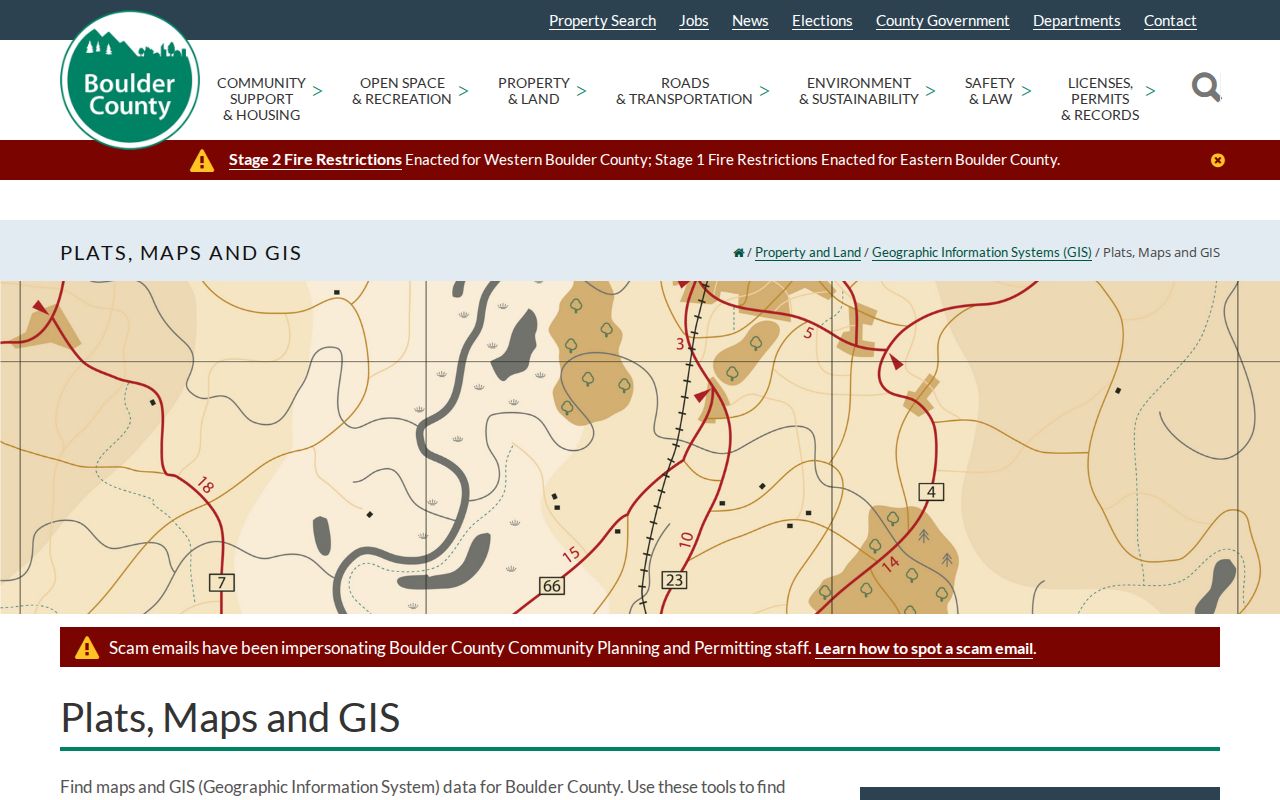
Selected historical indexes and local binders belong to the Louisville city directory collections layer, while this street workflow uses them only to resolve an address or past occupant. The distinction prevents a historical clue from being mistaken for a present-day street list.
Louisville Phones and Newspaper Records
The historic address layer is broader than a bound city volume. A verified 1902 telephone subscribers directory includes Louisville with Boulder, Broomfield, Eldora, Erie, Lafayette, Longmont, Lyons, Wallstreet, and Ward. It can supply a subscriber name, phone number, institution, or older spelling. It cannot measure the whole town, because many households and businesses did not appear in a telephone book.
The Louisville Times run in the Colorado Historic Newspapers Collection covers 1942-2007. CHNC spans 1859-2017 and more than 1.5 million pages. Carnegie holds Boulder County newspapers on microfilm from 1869-present, a Daily Camera archive arranged by surname or subject, and obituary indexes for 1859-1925 and 1960-present through the Boulder Genealogical Society collection. Search OCR, then check the page image because names and addresses can be misread.
The Louisville Historical Museum collections add photographs, oral histories, family and house material, maps, newspapers, and local directory references. Its photo catalog can be searched by street address or family name, and a catalog number supports a reproduction request. The Carnegie Branch for Local History and the museum are the right access routes when an old street name, initial, or business clue does not resolve online.
Louisville ZIP and Voter Limits
ZIP can narrow an address search, but it does not create a municipal street boundary. USPS sources pair 80027 and 80028 with Louisville. The retained 80027 last line has a postal history that includes a 2009 station change and a 2010 main-office entry, while a current USPS location result places a Louisville-labeled facility at 566 S McCaslin Boulevard in Superior. The live USPS lookup remains the right check for a street and unit. Use the parcel and city maps to decide whether the land is inside Louisville.
Colorado’s public voter lookup is also narrower than a street search. The required fields are First, Last, ZIP, and Birthday in MM/DD/YYYY format. The state says a failed match can reflect a name mismatch, recent move, confidential record, or a person under 18. Public voter data can include name, residential address, party and affiliation date, birth year, prior-election participation, and optional phone or gender. Full birth date, SSN, ID number, signature, and email stay confidential.
An authorized statewide voter-data request uses the state form, with listed $50 report products and a $1,000 subscription option. Boulder County Elections can be reached at 303-413-7740 or vote@bouldercounty.gov for the local route. Neither the individual lookup nor a report should be read as a ballot-choice list or as proof that every person at an address is present today. A protected voter may be absent from ordinary results.
Note: A failed voter match may reflect a recent move, a confidential record, or an exact-field mismatch rather than absence.
What Louisville Street Records Cannot Show
Street records are strong when the question is “which parcel, which instrument, or which dated source?” They are weaker when the question assumes a complete household. An owner can be a trust, estate, business, or absentee owner. A directory entry can describe a boarder, business, or telephone subscriber. A permit contact can be an architect, contractor, or applicant. A voter match can remain active after a move or be withheld under a protection program.
Protected voters and Colorado Address Confidentiality Program participants may not appear in ordinary voter results. Confidential vital records, sealed court matters, and private utility or delivery data are not open street layers. DMV address information is also limited by federal and Colorado privacy rules. When a result is missing, record the source date and use the custodian’s correction, protection, or records-request route instead of filling the gap with a guess.
Lawful use. Louisville address records support personal, lawful research. Do not use a name or address to stalk, harass, intimidate, or harm another person, and respect protected records and custodian limits.
A careful Louisville address entry therefore labels the evidence role: recorded owner, mailing contact, deed party, permit contact, voter registrant, historical occupant, or map parcel. That small discipline keeps a source-rich search from making a claim that no public record can support.